Where Disconnected Systems
Become Unified Intelligence
Connect With Us
Connect With Us
At the heart of DeepMatrix is a belief that systems should do more than store data, they should understand it. Our vision and mission reflect how we bring AI-led infrastructure intelligence to life.
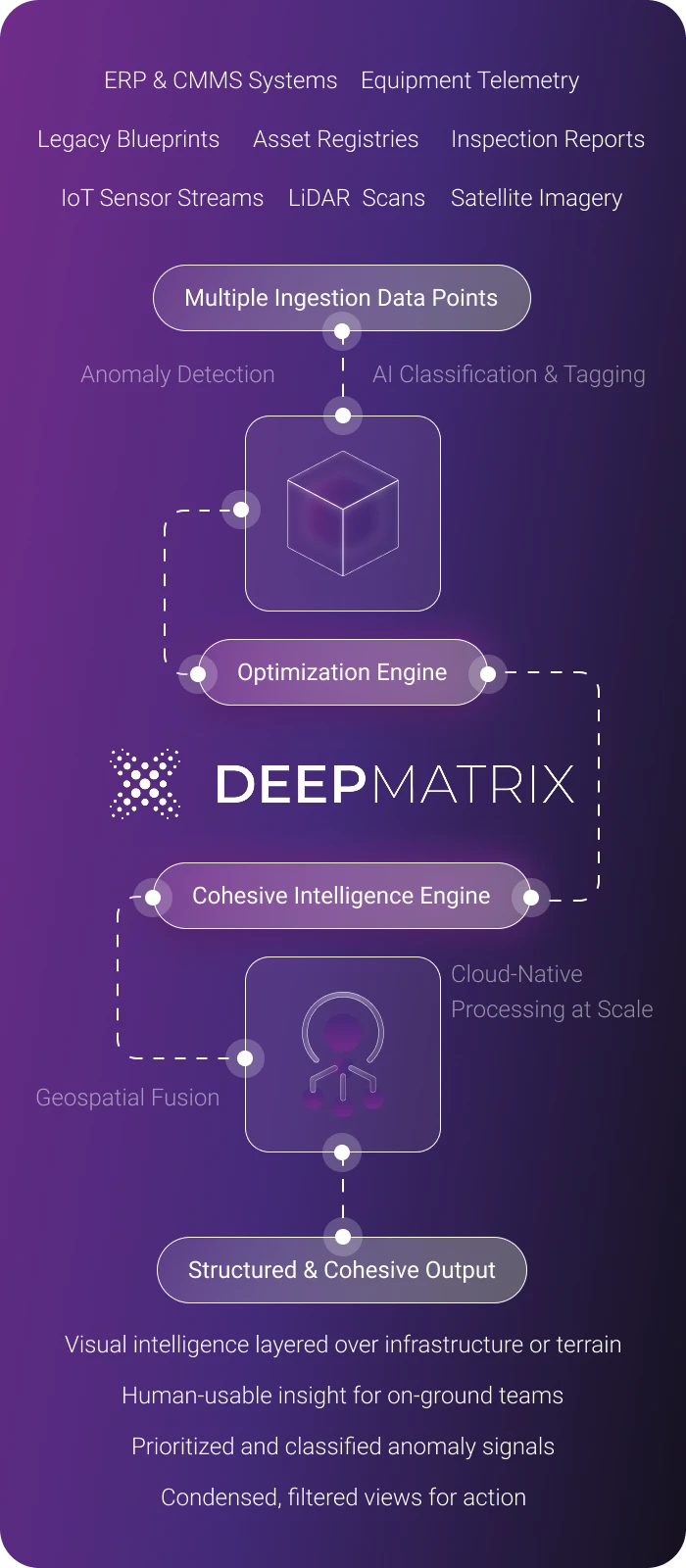
DeepMatrix uses AI and machine learning to optimize fragmented data across critical sectors. Its scalable intelligence layer adapts to each environment, turning disjointed inputs into high-precision, context-aware decisions.
Visualize terrain and infrastructure changes using AI-enhanced spatial and sensor fusion across field environments.
Flag structural shifts, thermal anomalies, or threshold breaches with machine learning models trained on multi-sensor inputs, ranked and mapped in real time.
Identify failure points using contextual machine learning models and anomaly detection across multimodal data, before breakdowns occur.
Distribute AI-classified insights to dashboards, field teams, or backend systems, automatically and at operational speed.
From power corridors to open-pit mines and urban growth zones, DeepMatrix applies AI to optimize field operations, enable predictive visibility, and scale intelligence across complex infrastructures.
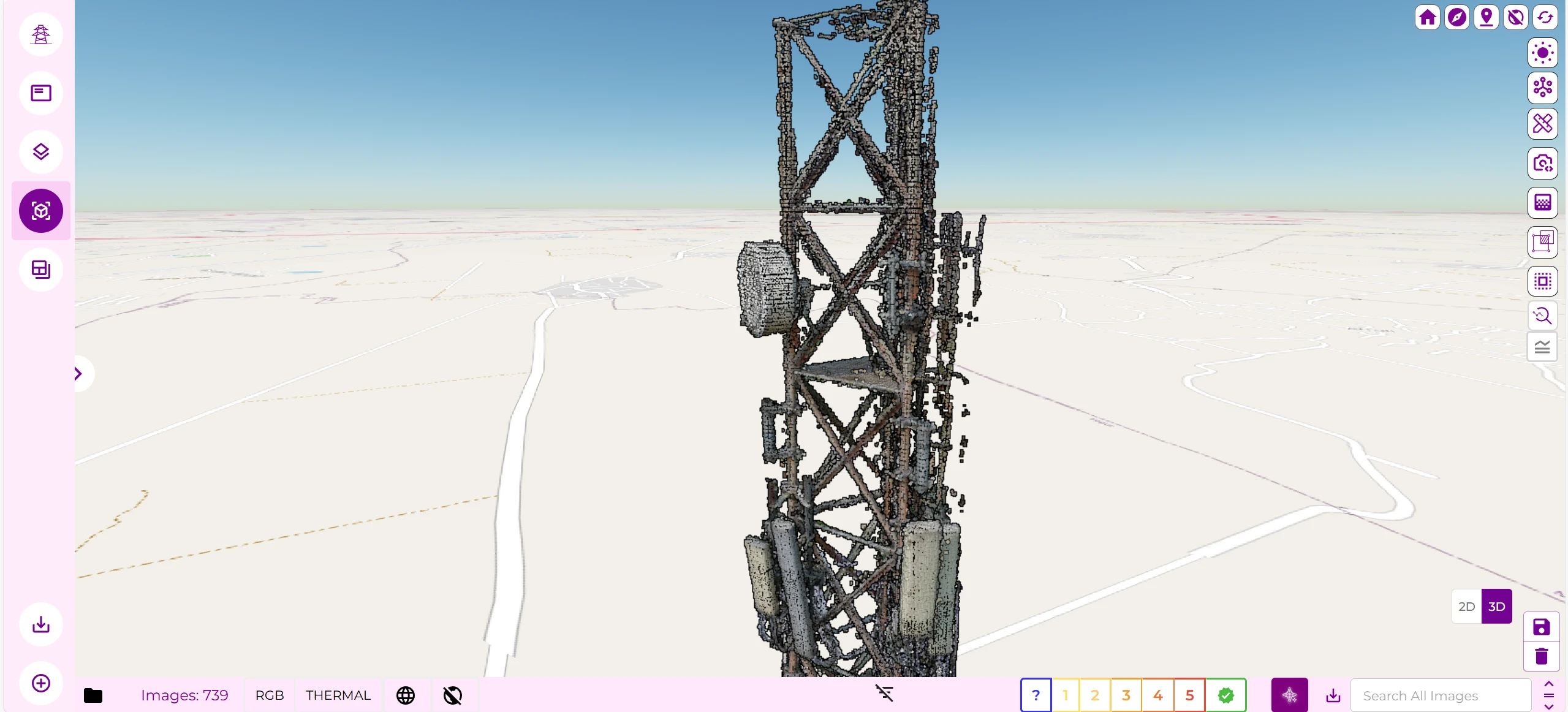
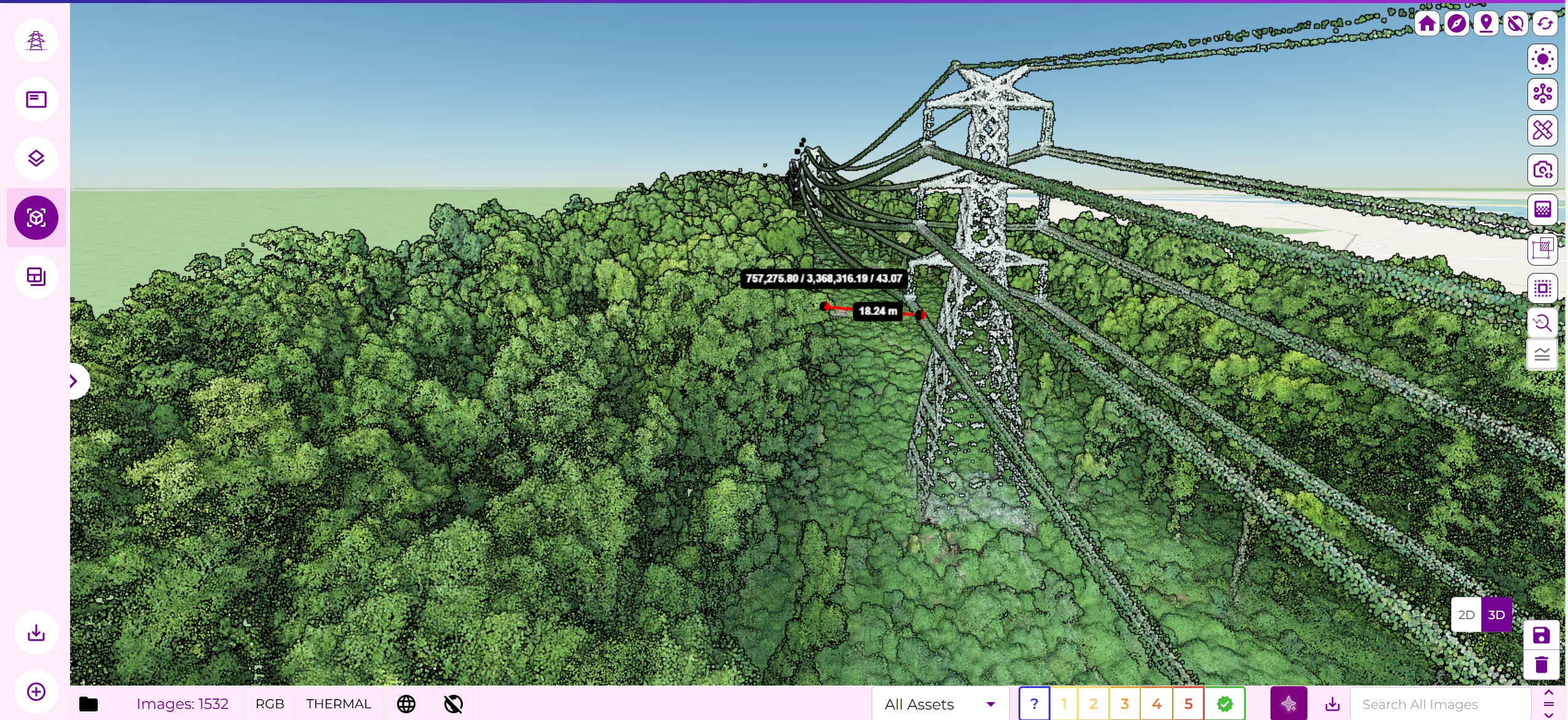
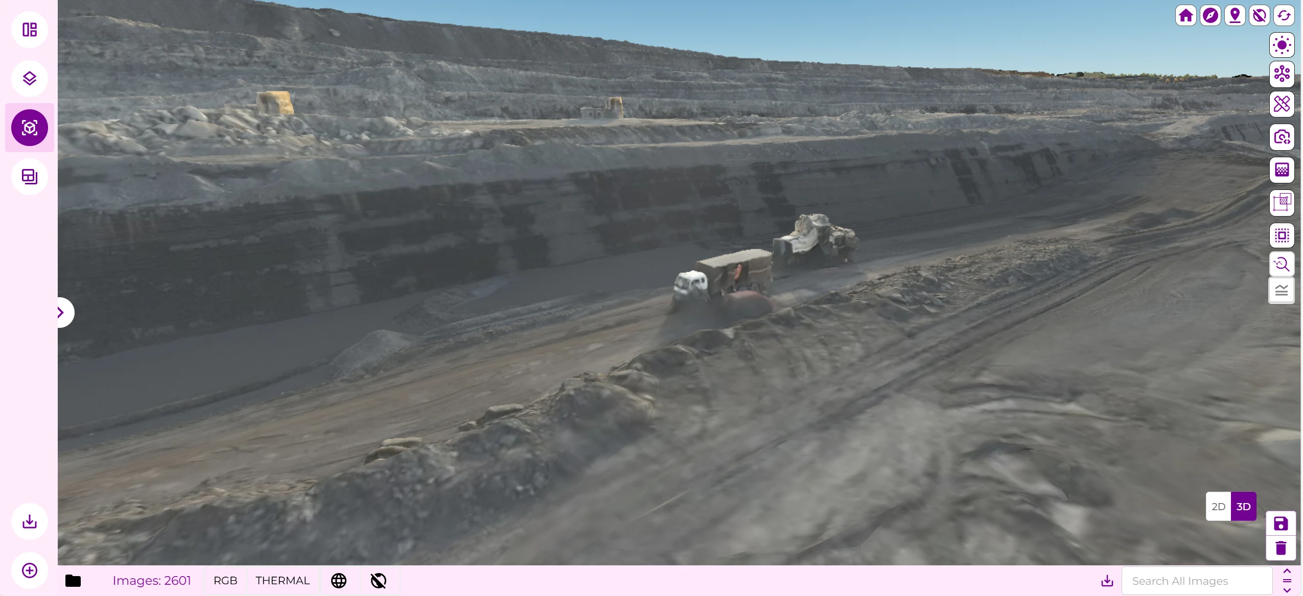
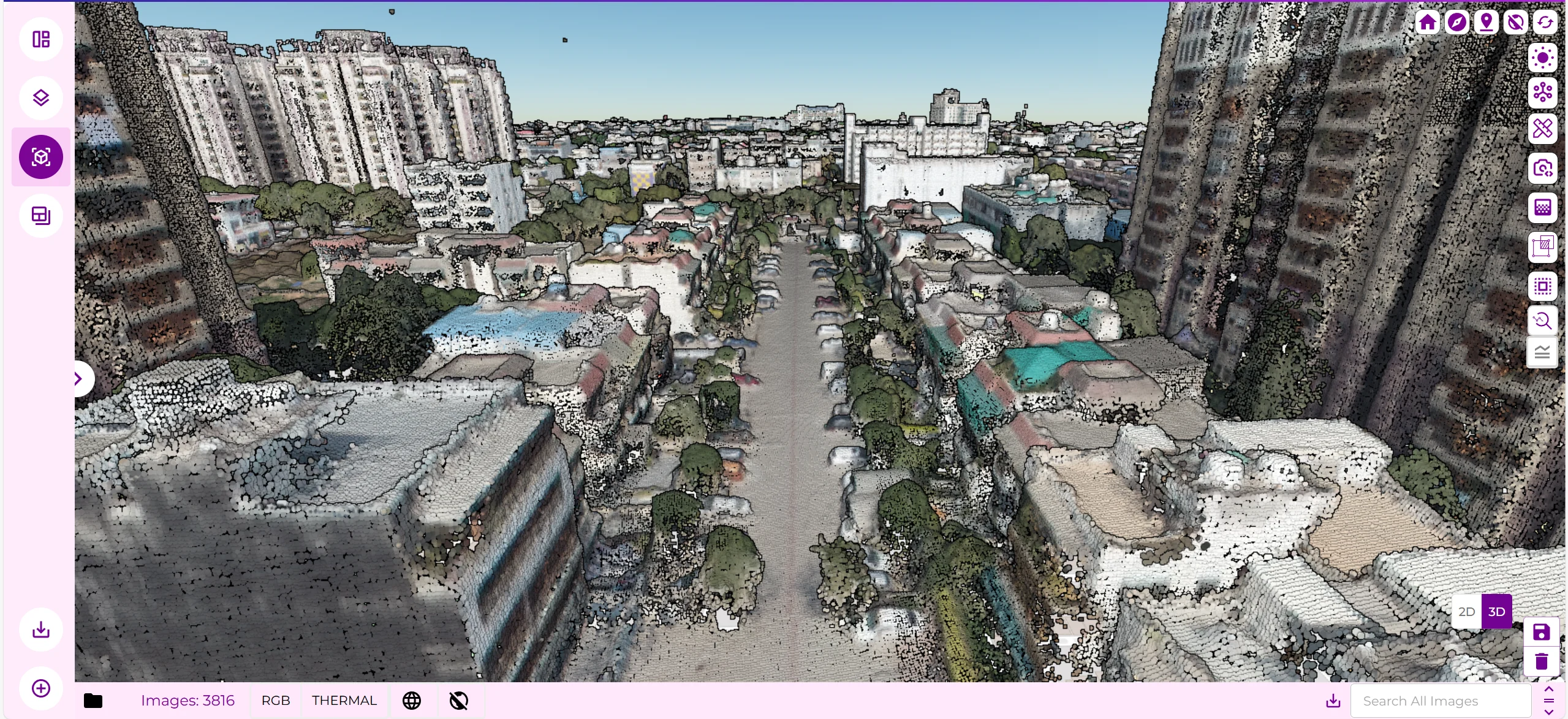
DeepMatrix applies machine learning to real-time sensor and spatial data, detecting patterns, predicting failures, and enabling smarter decisions before issues escalate.
Analyze thermal, vibration, or spatial signals with AI-trained models to surface anomalies. DeepMatrix pinpoints early risks across field, terrain, or structural layers.
Detect anomaly patterns and performance shifts before they cause failures. DeepMatrix continuously learns from system behavior to deliver predictive insights at scale.
Downtime Prediction
DeepMatrix uses AI to rank operational risks by urgency and context, so teams act faster, reduce downtime, and prevent cascading failures.
DeepMatrix uses AI, machine learning, and cloud-native infrastructure to reduce downtime, accelerate decisions, and scale operational intelligence, without disrupting existing systems.
(Observed across transmission and utility networks)
AI-powered detection enables faster interventions across remote infrastructure. DeepMatrix identifies early-stage anomalies before they escalate, preventing unplanned outages.
(Measured from drone upload to actionable dashboard layer)
DeepMatrix accelerates time-to-decision by analyzing and processing incoming data within hours. From drone upload to live dashboard, intelligence is ready at operational speed.
(Benchmarked across mining and telecom test deployments)
ML-driven diagnostics reduce false positives and surface only high-confidence risk events, minimizing manual triage and enabling smarter alerts at scale.
Let’s explore how DeepMatrix can streamline your operations, reduce risk, and deliver results, fast. No disruptions. Just smarter decisions from the ground up.
Get In Touch
Connect With Us
DeepMatrix fuses massive volumes of spatial, sensor, and system data through an AI-powered, cloud-native architecture. Every input is optimized, enhanced by context, ranked by urgency, and scaled infinitely across operations.
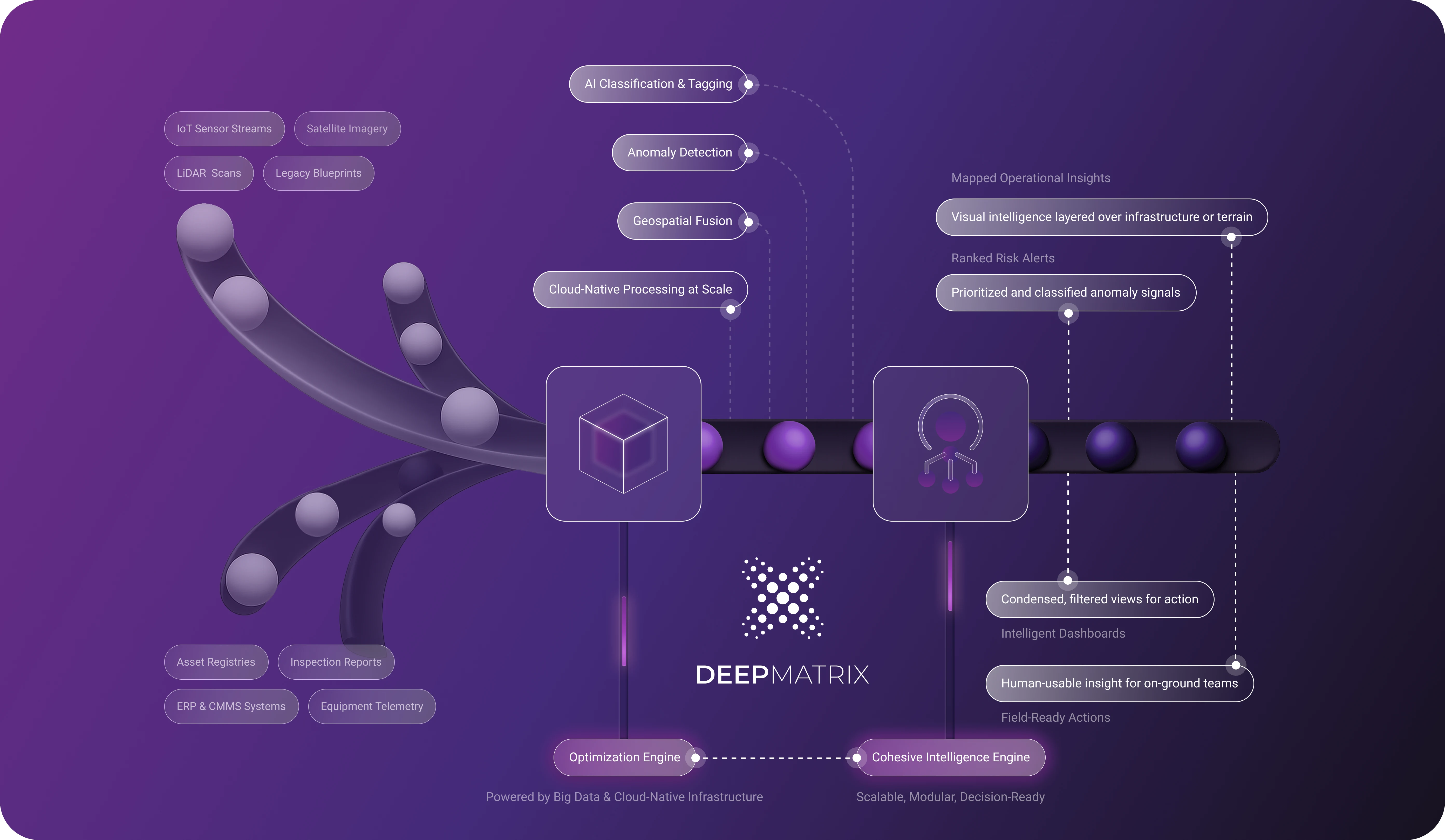
DeepMatrix uses AI and machine learning to optimize fragmented data across critical sectors. Its scalable intelligence layer adapts to each environment, turning disjointed inputs into high-precision, context-aware decisions.
Visualize terrain and infrastructure changes using AI-enhanced spatial and sensor fusion across field environments.
Flag structural shifts, thermal anomalies, or threshold breaches with machine learning models trained on multi-sensor inputs, ranked and mapped in real time.
Distribute AI-classified insights to dashboards, field teams, or backend systems, automatically and at operational speed.
Identify failure points using contextual machine learning models and anomaly detection across multimodal data, before breakdowns occur.
From power corridors to open-pit mines and urban growth zones, DeepMatrix applies AI to optimize field operations, enable predictive visibility, and scale intelligence across complex infrastructures.


DeepMatrix applies machine learning to real-time sensor and spatial data, detecting patterns, predicting failures, and enabling smarter decisions before issues escalate.
Analyze thermal, vibration, or spatial signals with AI-trained models to surface anomalies. DeepMatrix pinpoints early risks across field, terrain, or structural layers.
DeepMatrix uses AI to rank operational risks by urgency and context, so teams act faster, reduce downtime, and prevent cascading failures.
Downtime Prediction
12 month
30 days
7 days
24 hours
Detect anomaly patterns and performance shifts before they cause failures. DeepMatrix continuously learns from system behavior to deliver predictive insights at scale.
DeepMatrix uses AI, machine learning, and cloud-native infrastructure to reduce downtime, accelerate decisions, and scale operational intelligence, without disrupting existing systems.
AI-powered detection enables faster interventions across remote infrastructure. DeepMatrix identifies early-stage anomalies before they escalate, preventing unplanned outages.
DeepMatrix accelerates time-to-decision by analyzing and processing incoming data within hours. From drone upload to live dashboard, intelligence is ready at operational speed.
ML-driven diagnostics reduce false positives and surface only high-confidence risk events, minimizing manual triage and enabling smarter alerts at scale.
Let’s explore how DeepMatrix can streamline your operations, reduce risk, and deliver results, fast. No disruptions. Just smarter decisions from the ground up.
Get In Touch
We’ll walk you through use cases relevant to your industry.
From integration to industry relevance, here’s everything you need to know about how DeepMatrix delivers value, without complexity or disruption.
What is predictive maintenance?
Predictive maintenance uses AI to analyze data and predict equipment failures before they occur. This approach minimizes downtime and optimizes operational efficiency. By leveraging real-time insights, businesses can make informed decisions.
Is my data secure?
How does AI integration work?
What industries benefit?
Can I get support?